


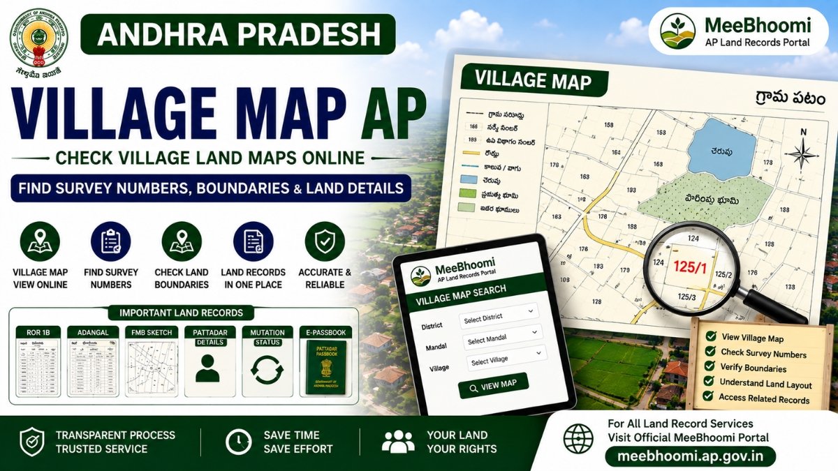
Village Map AP – Check Andhra Pradesh Village Land Maps Online
A Village Map AP is a survey-related map that helps users understand the layout and location of surveyed land parcels within a village. It can be useful when checking Survey Numbers, land boundaries, subdivisions, roads, water bodies and other mapped features, depending on the particular village record.
For land verification, a Village Map is best used together with records such as Adangal, ROR 1B, FMB Sketch, Survey Number and registered property documents.
The Andhra Pradesh Government’s Village Surveyor job chart assigns survey officials responsibilities including maintaining survey records, measuring and plotting subdivisions, pointing out field lines and incorporating new topographical details into relevant graphic records.
What Is a Village Map?
A Village Map is a graphical representation of surveyed land and other relevant features within a village.
Depending on the available survey record, it may help you understand:
- Survey Numbers
- Land parcel locations
- Survey subdivisions
- Field boundaries
- Roads and pathways
- Water bodies
- Government lands
- Other mapped/topographical features
The exact features shown can vary depending on the village, survey record and available government data.
How to Check Village Map in AP?
If Village Map information is available through the current online land-record service:
- Open the applicable official Andhra Pradesh land-record portal.
- Select the Village Map service.
- Select the required District.
- Select the Mandal.
- Select the Village.
- Open or view the available map.
- Locate the relevant Survey Number or land parcel where supported.
The online interface and availability of individual village maps can change, so use the instructions currently displayed on the official portal.
MeeBhoomi AP – Official Land Records Portal
What Can a Village Map Help You Check?
A Village Map can be useful for getting a broader graphical view of land parcels within a village.
It may help you understand:
- Where a Survey Number is located
- Relative position of neighbouring parcels
- Survey subdivisions
- Village-level land layout
- Roads and other mapped features
- Approximate relationship between different land parcels
However, the map should not be treated as a substitute for an official field survey when an exact boundary or measurement is disputed.
Village Map vs FMB Sketch
These two records serve different purposes.
Village Map
A Village Map provides a broader village-level graphical representation of surveyed parcels and other mapped features.
FMB Sketch
An FMB (Field Measurement Book) contains more detailed field measurement and survey information relating to individual parcels/subdivisions.
The AP Government’s Village Surveyor job chart specifically refers to measurement and plotting of subdivisions, FMB copies and incorporation of changes into village and Mandal accounts.
Therefore:
Village Map = broader village-level view
FMB = detailed field measurement/survey information
Village Map and Survey Number
The Survey Number is one of the most useful references when identifying a land parcel.
If you already know your Survey Number, compare it with:
- Village Map
- FMB Sketch
- Adangal
- ROR 1B
- Registered documents
- Pattadar Passbook
- Mutation records
This can provide a better picture of how the land is represented across different records.
Village Map and Adangal
Adangal is primarily a Revenue record containing applicable land, Pattadar, cultivation and crop-related information.
A Village Map is a graphical survey record.
They therefore provide different types of information and should not be treated as interchangeable.
If you are verifying a property, comparing the Survey Number and extent across both records can be useful.
Village Map and ROR 1B
ROR 1B is a Record of Rights document containing applicable rights/Revenue-record information.
A Village Map, on the other hand, provides a graphical representation.
For example, you may use:
- ROR 1B → Revenue/rights information
- Adangal → land and cultivation information
- FMB → detailed survey measurements
- Village Map → broader mapped location/layout
Using these records together can help identify inconsistencies that require further verification.
Can a Village Map Confirm Land Ownership?
No, not by itself.
A Village Map is primarily a survey/map record. It should not be treated as conclusive proof of legal ownership.
For ownership verification, examine the relevant documents and records, such as:
- Registered Sale Deed
- ROR 1B
- Adangal
- Mutation records
- Pattadar Passbook
- FMB
- Other applicable Revenue records
For a title dispute, obtain professional legal advice.
Can a Village Map Confirm Exact Boundaries?
A Village Map can help understand the general mapped position and relationship of land parcels, but an exact boundary determination may require official survey or demarcation.
The AP Government’s Village Surveyor functions include pointing out field lines on application and undertaking survey-related measurements and subdivision work.
If neighbouring landowners disagree about a boundary, do not rely only on an online map. Approach the competent Survey/Revenue authority for the appropriate procedure.
What If the Village Map and My Documents Do Not Match?
If you notice a discrepancy:
- Check the Survey Number.
- Check the Sub-Division Number.
- Compare the land extent.
- Check ROR 1B.
- Check Adangal.
- Check the FMB Sketch.
- Compare the registered property document.
- Check whether a mutation or subdivision has occurred.
- Approach the appropriate Survey/Revenue authority if the discrepancy remains.
A difference does not automatically mean that the land record is wrong. Older and newer survey records may need to be examined together.
Village Map for Land Boundary Verification
If you are investigating a boundary issue, the Village Map can provide useful context, but it should generally be considered alongside the FMB and other applicable survey records.
A practical verification sequence is:
Survey Number → Village Map → FMB → ROR 1B → Adangal → Registered Documents
If an exact demarcation is required, follow the applicable official survey process.
Village Map for Sub-Divided Land
Land parcels can be divided into smaller subdivisions.
For example:
Survey No. 125 → 125/1, 125/2, 125/3
The AP Government’s Village Surveyor job chart includes measurement and plotting of subdivisions and incorporation of related changes into village and Mandal accounts.
Therefore, when checking an older property, make sure you are looking at the current Survey Number/Sub-Division rather than relying only on an old document.
Important Records to Compare
| Record | Main Purpose |
|---|---|
| Village Map | Broader graphical village/survey view |
| FMB Sketch | Detailed field measurements and survey sketch |
| Survey Number | Land parcel identification |
| Adangal | Revenue/cultivation-related information |
| ROR 1B | Record of Rights information |
| Mutation | Applicable Revenue-record update |
| Pattadar Passbook | Pattadar/landholding-related record |
| Registered Deed | Registered property transaction document |
Frequently Asked Questions
1. What is a Village Map in AP?
A Village Map is a survey-related graphical record showing the layout of surveyed land parcels and other relevant mapped features within a village.
2. How can I check a Village Map online in Andhra Pradesh?
Use the applicable official Andhra Pradesh land-record service and select the required District, Mandal and Village where the online Village Map facility is available.
3. Can I find my Survey Number on a Village Map?
A Village Map may help identify the location of Survey Numbers, depending on the map and current online functionality.
4. Is Village Map the same as FMB?
No. A Village Map provides a broader village-level view, while an FMB generally contains more detailed field measurement and survey information.
5. Can a Village Map prove land ownership?
No. A Village Map should not be treated as the sole or conclusive proof of legal ownership.
6. Can a Village Map be used to settle a boundary dispute?
It can provide useful survey context, but an official survey/demarcation may be required to determine disputed boundaries.
Official Sources
MeeBhoomi AP – Official Land Records Portal
AP Government – Village Surveyor Job Chart
The AP Government’s official job chart describes the responsibilities of Village Surveyors, including survey-record maintenance, subdivision measurements, field-line work and updating relevant graphic records.
Disclaimer
MeeBhoomiAP.org is an independent informational website and is not affiliated with or operated by the Government of Andhra Pradesh.
Government portals, services, maps, procedures and available records may change. Always verify important land information through the official government portal or the competent Survey/Revenue authority.
This article is for general informational purposes and does not constitute legal advice. For ownership, boundary or title disputes, consult the appropriate authority or a qualified property lawyer.