


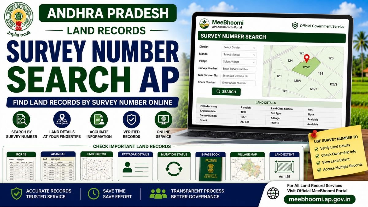
Survey Number Search AP – Find Land Records by Survey Number
A Survey Number is a key identifier used in Andhra Pradesh land and survey records to identify a particular parcel of land. A survey number may also have sub-divisions or hissa numbers, especially when a larger parcel has been divided.
If you want to verify land information, the Survey Number can be used along with details such as District, Mandal, Village and Khata Number in applicable Revenue and land-record services.
The Andhra Pradesh government’s survey documentation also confirms that Village Surveyors handle survey registers, measurements, subdivisions and related village/Mandal records.
What Is a Survey Number?
A Survey Number is a unique reference used in land and survey records to identify a parcel or portion of land within a village.
Depending on the property, you may also see:
- Survey Number
- Sub-Division Number
- Hissa Number
- Khata Number
- Extent
- Land Classification
- Pattadar/Khatadar details
A single original Survey Number can be divided into multiple sub-divisions after survey or partition-related changes.
How to Search Land Records by Survey Number in AP?
For available online land-record services, you should generally keep the following information ready:
- District
- Mandal
- Village
- Survey Number
- Sub-Division Number, if applicable
- Khata Number, where required
Then use the applicable official Andhra Pradesh land-record service to search or verify the available information.
The exact search fields and online services can change as government portals are updated.
MeeBhoomi AP – Official Land Records Portal
What Details Can Be Checked Using a Survey Number?
Depending on the service and available records, a Survey Number can help you locate or verify information related to:
- Pattadar details
- Khata Number
- Land extent
- Land classification
- Adangal/Pahani
- ROR 1B
- FMB Sketch
- Village Map
- Mutation records
- E-Passbook-related information
The information available depends on the particular government record.
Survey Number vs Khata Number
These two numbers are not the same.
Survey Number identifies a surveyed parcel or subdivision of land.
Khata Number is associated with the account/holding in the relevant Revenue records and may contain one or more Survey Numbers.
Therefore, if you are searching for a particular property, keep both numbers available whenever possible.
Survey Number and Sub-Division Number
A Survey Number can be divided into smaller portions.
For example, a record might show:
Survey No. 125/1
Here, 125 represents the main Survey Number and /1 represents a subdivision.
The exact format and terminology can vary between land records.
The AP Village Surveyor job chart specifically includes measurement and plotting of subdivisions and incorporation of related changes into village and Mandal accounts.
How to Find a Survey Number?
If you do not know the Survey Number of your land, check your available property documents first.
It may appear on:
- Registered Sale Deed
- Previous land documents
- ROR 1B
- Adangal
- Pattadar Passbook
- FMB
- Mutation records
- Other Revenue records
If the Survey Number cannot be established from the available documents, contact the appropriate Revenue or Survey authority.
Survey Number and Adangal
Adangal/Pahani is an important Revenue record that can contain information including landowner name, extent, Khata Number, Survey Number and Hissa Number, along with other land and cultivation-related details.
Therefore, Adangal can be useful when cross-checking a Survey Number.
Survey Number and ROR 1B
ROR 1B is another important Revenue record.
When checking land information, compare the Survey Number shown in ROR 1B with:
- Registered documents
- Adangal
- FMB
- Pattadar Passbook
- Mutation records
If the numbers or extent do not match, investigate the discrepancy through the appropriate Revenue authority.
Survey Number and FMB Sketch
The FMB (Field Measurement Book) contains survey-related field measurements and sketches.
It can be particularly useful when you need to understand:
- Field measurements
- Subdivisions
- Survey boundaries
- Parcel configuration
- Extent calculations
The AP government’s Village Surveyor job chart includes measurement and plotting of subdivisions and maintenance of FMB-related records.
What If the Survey Number Is Wrong?
If your land document and Revenue record show different Survey Numbers:
- Compare the registered document.
- Check ROR 1B.
- Check Adangal.
- Check the FMB Sketch.
- Check the Village Map.
- Verify mutation/subdivision records.
- Contact the appropriate Revenue or Survey authority.
Do not assume that an online entry is automatically correct or that a difference automatically means someone has changed your land record.
Can I Search Land by Survey Number Online?
Online land-record services can provide access to applicable information using land identifiers such as Survey Number, depending on the service currently offered.
However, not every land record or survey document may be available through the same online search.
For a formal survey, demarcation, correction or dispute, you may need to approach the competent Revenue/Survey authority.
Important Records to Compare
| Record | Main Purpose |
|---|---|
| Survey Number | Identifies the surveyed parcel/subdivision |
| Adangal | Land and cultivation-related Revenue information |
| ROR 1B | Record of Rights |
| FMB | Field measurements and survey sketch |
| Village Map | Village-level survey representation |
| Mutation | Updates applicable Revenue records |
| E-Passbook | Pattadar Passbook-related information |
Frequently Asked Questions
1. What is a Survey Number in AP?
A Survey Number is a land-record identifier used to identify a surveyed parcel of land within a village.
2. How can I search land records using a Survey Number?
Use the applicable official Andhra Pradesh land-record service and provide the required District, Mandal, Village and Survey Number details.
3. Can I find the owner name using a Survey Number?
Applicable Revenue records may display Pattadar/Khatadar information associated with a Survey Number, subject to the current government service and available records.
4. What is a Survey Number subdivision?
A subdivision is a separately identified portion created from an original Survey Number, such as 125/1.
5. Which document shows Survey Number and land extent?
Survey Number and extent can appear in multiple records, including Adangal, ROR 1B, FMB and registered property documents.
6. What should I do if my Survey Number is incorrect?
Compare your registered documents with ROR 1B, Adangal, FMB and other applicable records, then approach the appropriate Revenue or Survey authority for clarification or correction.
Official Sources
MeeBhoomi AP – Official Land Records Portal
The Andhra Pradesh government also publishes Revenue and Survey service documentation through the Gram/Ward Secretariat portal. The Village Surveyor job chart covers survey registers, subdivisions, measurements and FMB-related work.
AP Gram/Ward Secretariat – Official Portal
Disclaimer
MeeBhoomiAP.org is an independent informational website and is not affiliated with or operated by the Government of Andhra Pradesh.
Government portals, services, procedures and available land-record information can change. Always verify important property information through the official government portal or the appropriate Revenue/Survey authority.
This page provides general information and is not legal advice. For ownership, boundary, title or survey disputes, consult the competent authority or a qualified property lawyer.